Here’s How An Unexplored Mountain In Ladakh Was Scaled By A Brave Trio
Few people know that there are still mountains in the world that are yet to be scaled. This summer, a small expedition made the first ascent of one in Ladakh.
TEXT BY KEITH GOFFIN
PHOTOGRAPHS BY KEITH GOFFIN, TSEWANG GYALSON, AND JIGMET PHUNSTONG
Ladalh is home to many impressive mountains and I was keen to
climb them. I considered going alone but the Indian Mountaineering Foundation (IMF), which administers expeditions, has a rule that any group visiting border mountains in India must include at least two foreigners, if the peak is close to the border. I couldn’t find another interested climber—active mountaineers of my age (60+) are hard to find! But a (young) Ladakhi friend, Tsewang Gyalson, was interested. He felt we would get permission to climb the mountains far from the border, near his home village of Hunder Dok. Tsewang’s friend, Jigmet Phunstong, agreed to join us, too. Now, there would be three of us climbing, which is safer on glaciers. And a plan emerged.
The Plan
The Himalayan Journal revealed that most peaks near Hunder Dok had already been climbed. However, using satellite images, we found a side valley that mountaineers had never visited. And this hidden valley had four unclimbed mountains. Now, we needed to find a way to get to the valley with our climbing and camping equipment. There were no paths to be seen on satellite pictures and we would have to cross a very steep ridge. Villagers told us there was a shepherds’ path, used to take sheep to higher pastures in the summer. But, what a Himalayan shepherd calls a “path” can correspond to anything from a stroll to a steep struggle! Plus, we were told that the path had not been used since the 2010 cloudburst. Optimistically, we hoped the path would be passable with the horses needed to carry our equipment. The plan was to approach Hunder Dok from a northerly direction and then use the shepherds’ path to access our hidden valley.
Not Quite According to Plan
I reached Leh and spent a few days acclimatising and preparing. The IMF team there was extremely helpful and issued the necessary permits. We were ready to go! However, the Dalai Lama was visiting Ladakh and scheduled to give sermons on three successive days, which happened to clash with our dates. As our horseman wanted to attend the sermons, we had to change our plan and approach Hunder Dok from a southerly direction, via the Lasirmo La pass. All went well on our approach march. Except for the weather. We climbed in cloud and rain, which changed to sleet as we reached the 5,400-metre-high glacier pass. At that height, we should have been rewarded with stunning views of the Himalayas. Instead, we had 200-metres visibility and a panorama of grey-on-grey. The poor weather continued on subsequent days, and we became used to damp tents and zero possibility of charging camera batteries with solar power. But poor mountain weather is just a matter of patience… we hoped.
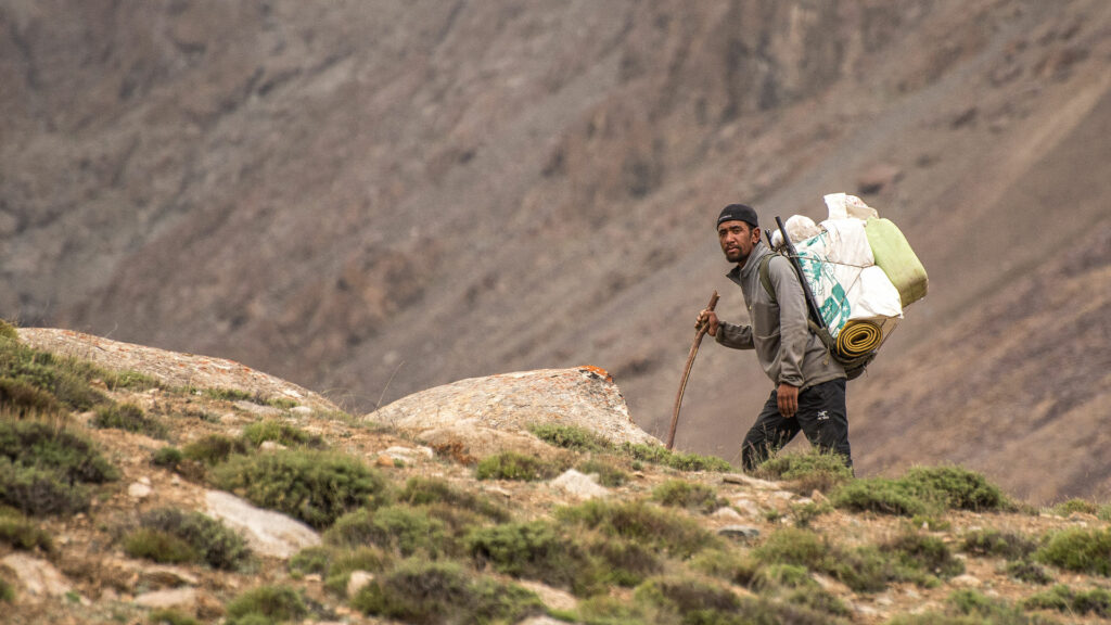
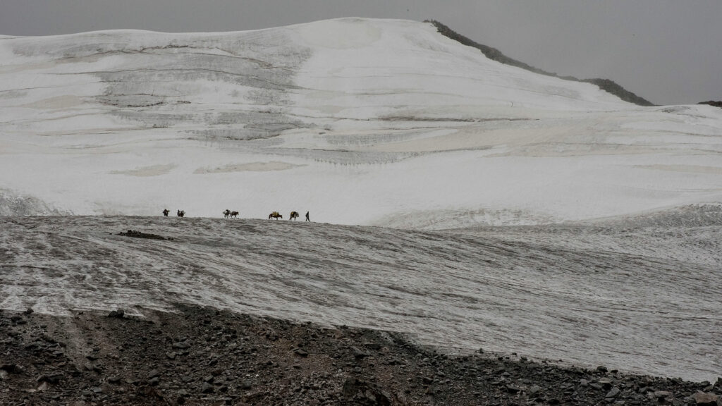
After four days of descending from the pass, we arrived at Hunder Dok. On checking the shepherds’ path, we found that the route up to the ridge was dangerously loose and clearly impossible for horses. This led to a search for porters but, of course, everyone was going to the Dalai Lama’s sermons. Tsewang negotiated with his relatives and three ‘porter cousins’, who saved the day, carrying our equipment up the steep and difficult terrain to the base camp (BC). At 5,000 metres, we pitched our BC on a pasture half the size of a cricket field, dotted with wild flowers. As we waited, there was yet more rain. Luckily, the clouds cleared occasionally and we managed a glimpse of the mountains.
A few kilometres from our BC was what mountaineers call an ‘interesting’ peak. Translation: With snow and ice slopes at a 50°+ angle—possible to climb, but not too easy. Two days later, we woke
up at 5 am to blue skies and a feeling our patience was about to be rewarded. We packed our climbing equipment, tent, and several days’ food, and began climbing higher, looking for a place to set up our advanced base camp (ABC). At 5,400 metres, we dug a platform in the middle of the moraine. The weather was still perfect and Tsewang climbed 200 metres to recce the route for the next day, while two of
us cooked. We prepared a freeze-dried camping stew, joking that the bland contents of the package didn’t taste as good as the fresh vegetables and spices we had enjoyed at BC. As the temperature quickly dropped to freezing, we went to bed around 8 pm.
The Ascent
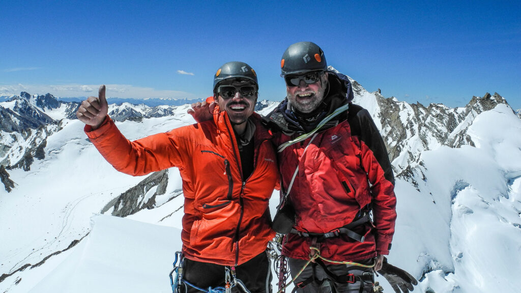
Climbing a Himalayan peak requires an ultra-early start because you need to summit and descend before the afternoon sun makes snow slopes prone to an avalanche. We arose at 2:30 am. The weather was perfect: –2°C, with a slight wind. Leaving our ABC in the pitch dark, we climbed with head torches over what seemed like never-ending, loose, rocky flanks. By dawn, we reached the glacier and attached crampons (climbing spikes made of metal) to our boots. We climbed up the snow and ice slopes at an incline of 30°–40°, using ice axes, with the altitude making breathing increasingly difficult. Next, we reached a ridge and the angle steepened to 50°+ with overhanging cornices. For safety, we used ropes to climb the last 250 metres, reaching the 6,037-metre-high summit at 10:30 am.
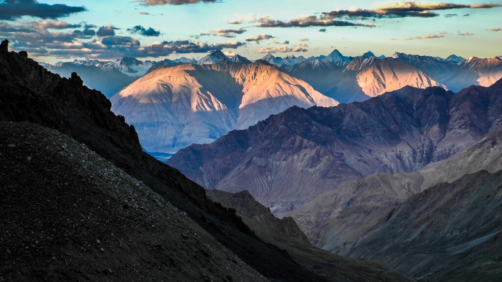
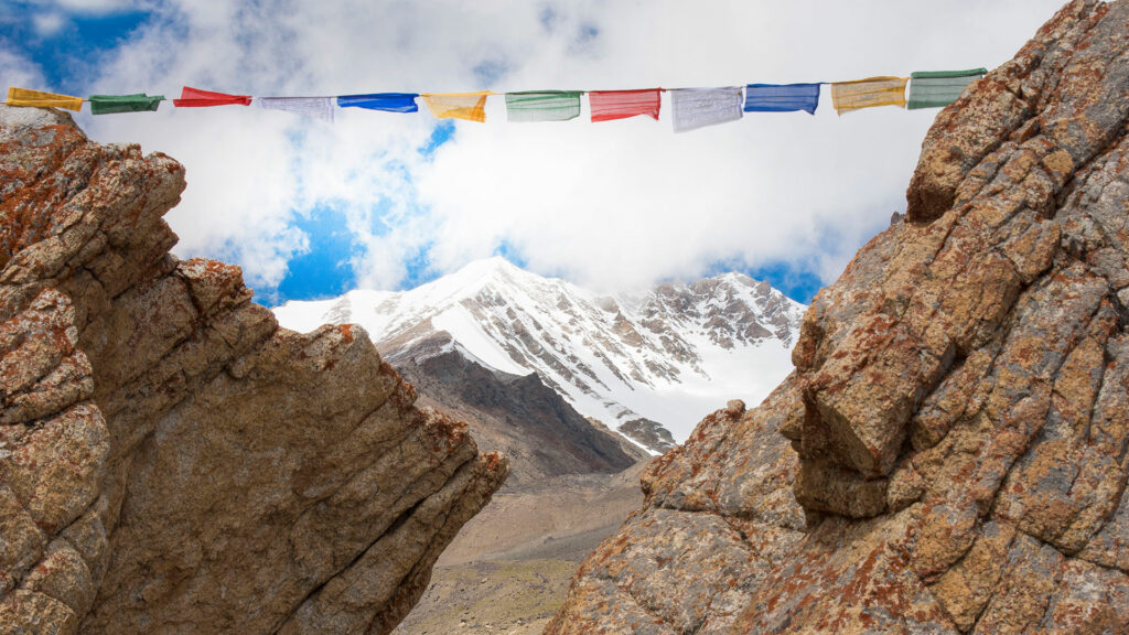
The summit panorama was breathtaking! On one side were massive, snow-clad mountains of the East Karakoram range. On the other side, adjacent to our peak, was an unclimbed mountain, resembling a fortress and guarded by glacier slopes with crevasses the size of trains! We were in awe. Tsewang and Jigmet made piles of rocks, so they could hang prayer flags and chanted Kiki So So Lhargyalo (Victory to the Mountain Gods), a Buddhist prayer recited on summits. We congratulated each other but, as always, summit celebrations were muted as mountaineers are cautious about the descent (often more dangerous than the ascent). After recording a 360° angle summit video—needed to provide proof we had reached the summit— Tsewang took a picture of our BC, over 1,000 metres below. “There’s something wrong,” he said. “Our cooking tent has fallen down!” I checked using the camera zoom. He was right. Our carefully pitched tent was lying flat. But why? Somewhat puzzled, we decided to descend.
Yak, Yak Attack
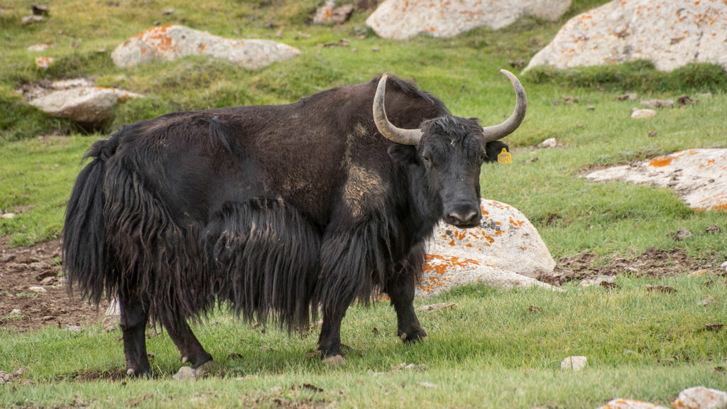
The mystery was immediately solved as we arrived at BC. Two yaks and about 20 cattle were in the valley and had trampled our tent. They had then feasted on all our fresh vegetables, spiced with 1 kg each of garlic and ginger, 10 kg of flour, and a set of boxes of curry powder, garam masala, turmeric, and baking powder. The yaks had clearly enjoyed it but the combined laxative effects of the spices and baking powder were all too obvious from the appearance of the flattened tent! That evening we ‘feasted’ on plain rice and our last tin of tuna, watched by the (still) hungry yaks.
Naming the Peak
As the peak was not officially registered, the tradition is that we, as the first ascensionists, could name it. The Hunder Dok villagers told us the valley below it is known for providing the best milk. That led to the now registered name, Oma Kangri; Kangri is Ladakhi for snow peak and Oma means milk. In total, the expedition took us nearly two weeks. And the three of us are delighted to have made a successful first ascent. I personally have a wealth of memories of the hospitality and support I received from the Ladakhi people I met. And I will be back again.
Related: Here’s Why You Need To Opt For A Nature Trail On Your Next Trip